
Peyto Lake: Banff's Bluest Lake Discovering the Shoreline Hike – Icefield Parkway


Peyto Lake
📍 AT A GLANCE |
📍 Location: Icefields Parkway, Banff National Park |
🏔 Elevation: Approximately 6,800 ft (2,070 m) |
💎 Water Color: Brilliant Sapphire Blue |
🥾 Best For: Iconic Viewpoint & Hidden Shoreline Hike |
⏰ Time Needed: 1–3 Hours |
❤️ Why We Love It: We experienced two completely different versions of the same incredible lake. |
💡 Our Tip: Visit both the famous overlook and the Access Trail. |
History
Peyto Lake was named after Bill Peyto, one of Banff National Park's earliest guides, outfitters, and park wardens. Known for his adventurous spirit and distinctive handlebar mustache, he spent much of his life exploring the Canadian Rockies. Today, his name lives on through one of the park's most photographed lakes.
What Makes Peyto Lake Unique?
If Lake Louise is famous for its brilliant turquoise waters, then Peyto Lake might just be the bluest lake I've ever seen.
Rather than the softer turquoise tones of Lake Louise, Peyto glows with an incredibly vibrant sapphire-blue color that immediately catches your attention. Like many lakes in the Rockies, the color comes from glacial rock flour carried into the lake by meltwater from the Peyto Glacier. Those microscopic rock particles remain suspended in the water, scattering sunlight and creating the lake's remarkable color.
From high above, another unique feature becomes obvious. Peyto Lake is famous for its distinctive wolf-shaped outline. Once someone points it out, it's surprisingly easy to recognize the head of a wolf stretching into the valley below.
Fortunately, one of Banff National Park's easiest spectacular viewpoints makes it possible for almost everyone to enjoy this incredible perspective. A large parking area accommodates tour buses, RVs, and cars, while a short paved trail leads to the overlook. It's easy to understand why this has become one of the park's most popular stops.
Our Experience - Peyto Lake: Beyond the Famous Overlook

We arrived at the overlook, took one look at the crowded parking lot, and decided to come back another time.
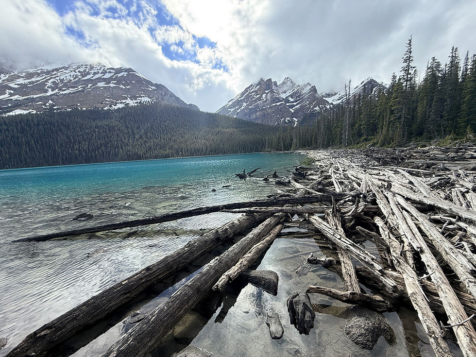
We really wanted to see Peyto Lake. Getting to down to the actual lake is a lot more work than Lake Louise and Moraine lake – we found a pull off – no other vehicles - and took the Peyto Lake Access trail – the trail to the lake is just under a mile – pretty straight down through a nice tree trail – no view of the lake really from the top – probably why only us in the lot – this is one of those trails where once you reach the bottom you come out of the trees and The suddenly you have arrived!

Peyto Lake welcomes you into its world.
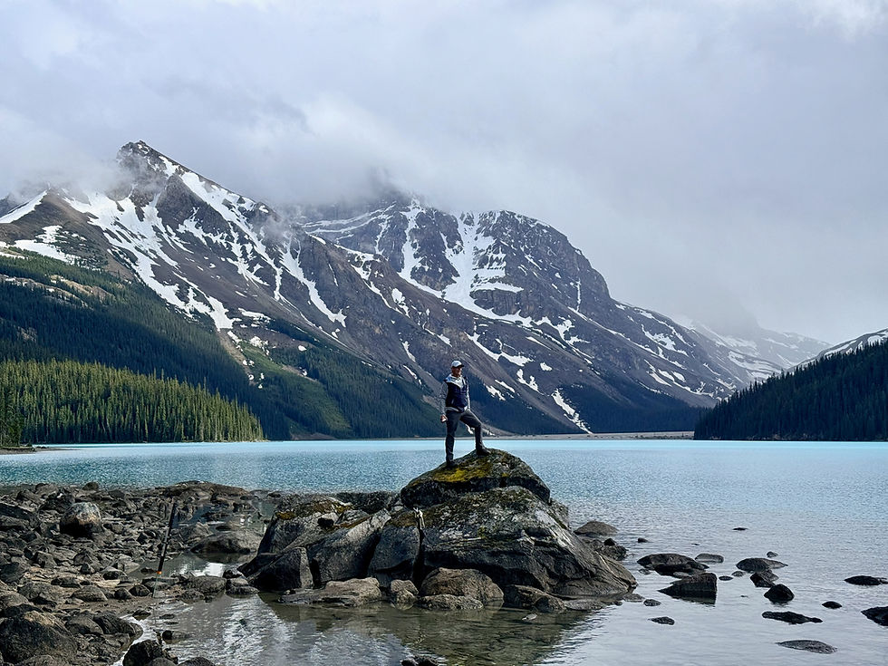
Peyto Lake is so blue it just stops you for a moment while you try to take it all in – there are no hotels, tour buses this lake is a very personal visit. We had the entire lake as far as we could see – to ourselves. We wandered around the shore line ,picking over rocks – following half trails – both directions from our entrance area. We admired the clear water and numerous rivers and streams coming into Peyto.
We longed for a canoe to paddle across the lake – but no way would we have ever been able to get one down that trail! We spent a couple of hours just enjoying it- exploring – taking it in. Hiked back up to the truck with a lot of satisfaction in the experience.
Famous Overlook
Before leaving, we did return to the famous overlook. Seeing Peyto Lake from above gave us an entirely different appreciation for its famous wolf-shaped outline. Having already experienced the lake from the shoreline, we found ourselves smiling because we had enjoyed two completely different versions of the same incredible place.


Tips
If you have time, I highly recommend experiencing both Peyto Lake viewpoints.The famous overlook offers one of the most iconic panoramic views in the Canadian Rockies and is absolutely worth seeing.But if you're looking for solitude and a completely different perspective, the Peyto Lake Access Trail is an experience many visitors never discover.You'll need the AllTrails app to locate the trailhead, as it sits quite a distance from the main overlook and is easy to miss if you don't know where you're going.

Comments